
Page 1/1
Harbour Plan of Louisbourg
Dates of Creation: [ca. 1716]
Physical Description: 1 map : b&w ; 15.5 x 21 cm
Location: Cape Breton Regional Library - McLennan Collection
Reference Number: CBRL SB.P3a
Scope and Content:
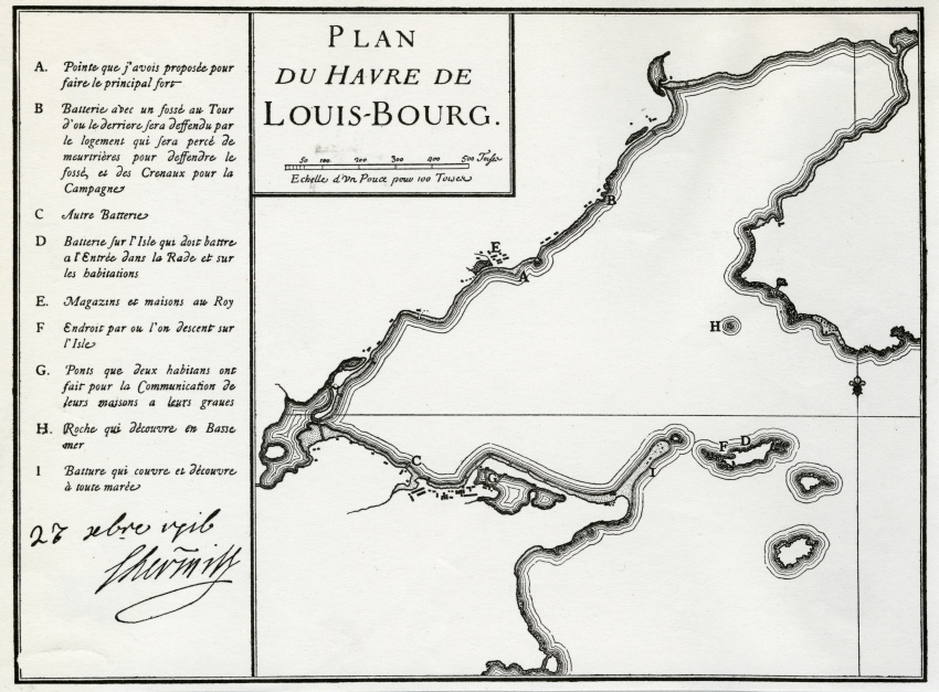
Item is a reproduction of a map of the Harbour Plan for Louisbourg. The plan shows the islands present at the entrance to the harbour, as well as the fortifications and the town. A legend that is found on the map indicates several key locations within the harbour, including the batteries, the location for the proposed fort, and dangerous rocks at sea (for which a lighthouse would later be constructed).
Notes: Item was included in a scrapbook that was compiled by Katharine McLennan, which she donated to the Cape Breton Regional Library.
SHARE


CONTACT US
